What We Do
What We Do
Our mission is to preserve as much land as possible
North American Land Trust (NALT) is 501c3 conservation charity whose mission is to permanently conserve and steward natural and cultural resources through innovative land preservation partnerships. NALT is in its 33rd year of operation and has permanently preserved more than 139,000 acres of natural land in 24 states, mostly through permanent conservation easements.
NALT partners with landowners, municipalities, the real estate community, and other groups to protect environmentally and culturally significant landscapes that otherwise may be lost to alternative uses. Once a property is under NALT’s permanent stewardship, our experienced team of conservation professionals regularly monitor the land to ensure the integrity and longevity of the conservation resource.
How We Do It
We accomplish land preservation through a variety of strategies and utilize our experience and expertise
to find solutions to a range of complex conservation and management challenges.
NALT’s conservation strategies include:
- Land Protection
- Conservation Management
- Monitoring & Stewardship
- Planning & Design
- Research & Education
Land Protection
Conservation Easement
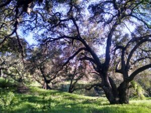
A conservation easement is a legally binding agreement where-in a landowner donates certain development rights associated with the land to a land trust. The donated property’s use is permanently limited to protect its conservation attributes and values.
Charitable Conservation Easement
In 2006, Congress substantially improved one of the most powerful conservation measures in decades: the enhanced federal tax incentive for voluntary conservation easement donations. The conservation easement tax incentive is an important tool that helps Americans conserve their land voluntarily.
Learn more: NALT Conservation Easement Tax Incentive
Mitigation Conservation Easement
Development that impacts water resources and endangered and threatened species habitats must be offset by government regulated mitigation projects to abate the loss of these important resources. Mitigation projects often require a permanent conservation easement and specific long-term management to ensure their success. NALT is currently a member of National Environmental Banking Association and the Ecological Restoration Business Association and has partnered on over 45 mitigation projects as a conservation easement holder and long-term steward. Thanks to our team’s expertise and geographic reach, we are uniquely qualified to assist with these functions at the national level.
Learn more: Mitigation Banking with NALT (coming soon)
Examples: Yockanookany Mitigation Bank, Delmarva Fox Squirrel Species Bank
Municipal Conservation Easements
NALT partners directly with municipalities across the country to help permanently conserve publicly owned parks and open spaces. These projects have abundant community benefits and demonstrate the municipalities’ commitment to the permanent protection of these publicly-owned resources.
Examples: East Bradford Township, Altama Plantation Wildlife Management Area
NALT also works with municipalities to help fulfill their unique subdivision or open space ordinances as it relates to development and infrastructure projects
Examples: City of Naples Open Space
Preserves and Land Acquisition
NALT also identifies important conservation properties for permanent acquisition and long-term management and programming. Property size, proximity to NALT projects and service areas, and ecological or historical context are just some of the variables that are carefully evaluated.
Examples: Brinton Run Preserve, Knights Island Preserve, All Projects
Learn about our latest acquisition target, the Joseph Davis Tract in Chadds Ford, PA
Conservation Management
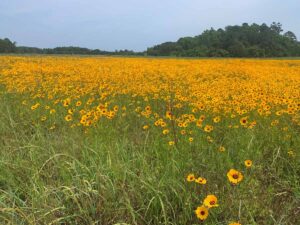 NALT is committed to supporting each landowners ongoing efforts to carry out active property management and responsible stewardship. In many mitigation projects, long-term property management and stewardship is a required component by the regulatory agency.
NALT’s experienced team of natural resource managers can assist with the development and implementation of a customized Conservation Management Plan which will provide a road map of land management strategies that property owners can undertake in order to maintain and enhance the conservation values and natural resources on their property. Experience has shown that proper land management can add both ecological enhancement and economic value to a property.
NALT’s Conservation Management services include:
- Invasives species management
- Habitat improvement for wildlife
- Forest management
- Restoration assessment
- Pollinator habitat implementation
- Customized management plans
Monitoring & Stewardship
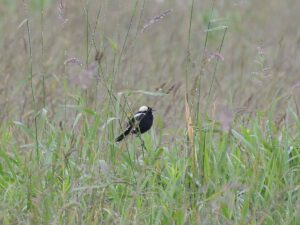 Conservation easement monitoring and stewardship is a fundamental responsibility for every land trust. NALT is committed to and has the resources to monitor each conservation easement it manages annually in strict adherence with its organizational policy. NALT stewardship team focuses on building and maintaining positive landowner relationships which has resulted in a low overall rate of compliance issues over its 30-year history.
Monitoring Techniques:
- Imagery – We use the latest, high-resolution satellite imagery which helps protect our landowners against any potential neighbor encroachments and helps track changes to the land over time.
- Boots on the Ground – NALT’s stewardship team physically visits each conservation easement at least once every 3 years. When possible, we meet with landowners or property managers to provide guidance regarding stewardship, land management, potential projects, or concerns.
- Unmanned Aerial Vehicles – Occasionally, monitoring certain easements or sections of our easements can be difficult due to challenging terrain or limited access to specific areas of the easement. In these circumstances, we may utilize UAV’s (drones) to gather photos or video footage of a property.
Planning & Design
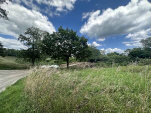
NALT has over 30 years of experience assisting landowners with planning for land protection, habitat enhancement, and developing customized conservation strategies for their properties. Like many land trusts, natural resource planning and design is an important service we provide to landowners.
Unlike most land trusts however, NALT believes that non-traditional landowners can also be engaged. NALT has a long, proud history of successfully partnering with government agencies, municipalities, developers, corporations, and the real estate community at large to help effectuate balanced and meaningful project outcomes.
This is never a one size fits all approach, but NALT has a proven track record of protecting and stewarding extraordinary places by “reaching across the aisle” to help conserve important land.
NALT’s planning and design teams can provide:
- Natural resource documentation and mapping
- Assistance with the planning of appropriate development areas
- Management strategies compatible with a limited development vision
- Advocacy and promotion of the conservation story
- Creation of partner organizations dedicated to long-term stewardship of the resource and to engage the ownership and community base
Examples: Palmetto Bluff Conservancy
Research & Education
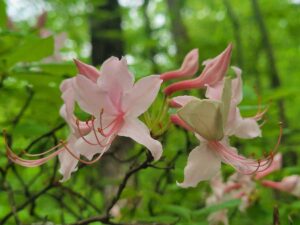 NALT’s project areas represent a broad range of ecosystems in some of the most biodiverse regions of the country. These conservation areas provide not only an extensive database of biodiversity data across private lands, but they also act as a living laboratory. Many of our conservation easements provide opportunities for public outreach and education and can also act as a bridge for partnerships with scientists and colleagues working in universities, non-profits, and state and federal organizations. These collaborations are at the core of NALT’s values and are paramount to the organization’s culture and mission. It’s another way we can give back to the communities where we live and work.
Whether it’s hosting conservation lectures, publishing our “Species Spotlights” series, providing resources for landowners and partners, or facilitating important research projects, NALT’s staff is committed to maintaining regular engagement with its public stakeholders.
How We Do It
We accomplish land preservation through a variety of strategies and utilize our experience and expertise
to find solutions to a range of complex conservation and management challenges.
Land Protection | Conservation Management | Monitoring & Stewardship | Planning & Design | Research & Education
Land Protection
Conservation Easement
A conservation easement is a legally binding agreement where-in a landowner donates certain development rights associated with the land to a land trust. The donated property’s use is permanently limited to protect its conservation attributes and values.
Charitable Conservation Easement
In 2006, Congress substantially improved one of the most powerful conservation measures in decades: the enhanced federal tax incentive for voluntary conservation easement donations. The conservation easement tax incentive is an important tool that helps Americans conserve their land voluntarily.
Example(s): NALT Conservation Easement Tax Incentive
Mitigation Conservation Easement (aka Site Protection Instrument)
Development that impacts water resources and endangered and threatened species habitats must be offset by government regulated mitigation projects to abate the loss of these important resources. Mitigation projects often require a permanent conservation easement and specific long-term management to ensure their success. NALT is currently a member of National Environmental Banking Association and has partnered on over 45 mitigation projects as a conservation easement holder and long-term steward. Thanks to our team’s expertise and geographic reach, we are uniquely qualified to assist with these functions at the national level.
Example(s): NALT Mitigation Banking, Yockanookany, Delmarva Fox squirrel
Municipal Conservation Easements
NALT partners directly with municipalities across the country to help permanently conserve publicly owned parks and open spaces. These projects have abundant community benefits and demonstrate the municipalities’ commitment to the permanent protection of these publicly-owned resources.
Examples: Hyperlink East Bradford Township SFTL, Altama Plantation SFTL, or other relevant examples.
NALT also works with municipalities to help fulfill their unique subdivision or open space ordinances as it relates to development and infrastructure projects
Example(s): Naples
Preserves and Land Acquisition
NALT also identifies important conservation properties that have the right profile for permanent acquisition and long-term management and programming. The property size, proximity to other NALT projects and service areas, and the ecological or historical context are just some of the variables that are carefully evaluated.
Example(s): Brinton Run Preserve, Knights Island, All Projects
Conservation Management
 NALT is committed to supporting each landowners on-going efforts to carry out active property management and responsible stewardship. In many mitigation projects, long-term property management and stewardship is a required component by the regulatory agency. NALT’s experienced team of natural resource managers can assist with the development and implementation of a customized Conservation Management Plan which will provide a road map of land management strategies that property owners can undertake in order to maintain and enhance the conservation values and natural resources on their property. Experience has shown that proper land management can add both ecological enhancement and economic value to a property.
NALT’s Conservation Management services include:
- Invasives species management
- Habitat improvement for wildlife
- Forest management
- Restoration assessment
- Pollinator habitat implementation
- Customized management plans
Monitoring & Stewardship
 Conservation easement monitoring and stewardship is a fundamental responsibility for every land trust. NALT is committed to and has the resources to monitor each conservation easement it manages annually in strict adherence with its organizational policy. NALT stewardship team focuses on building and maintaining positive landowner relationships which has resulted in a low overall rate of compliance issues over its 30-year history.
Monitoring Techniques:
- Imagery – We use the latest, high-resolution satellite imagery which helps protect our landowners against any potential neighbor encroachments and helps track changes to the land over time.
- Boots on the Ground – NALT’s stewardship team physically visits each conservation easement at least once every 3 years. When possible, we meet with landowners or property managers to provide guidance regarding stewardship, land management, potential projects, or concerns.
- Unmanned Aerial Vehicles – Occasionally, monitoring certain easements or sections of our easements can be difficult due to challenging terrain or limited access to specific areas of the easement. In these circumstances, we may utilize UAV’s (drones) to gather photos or video footage of a property.
Planning & Design
 NALT is committed to supporting each landowners on-going efforts to carry out active property management and responsible stewardship. In many mitigation projects, long-term property management and stewardship is a required component by the regulatory agency. NALT’s experienced team of natural resource managers can assist with the development and implementation of a customized Conservation Management Plan which will provide a road map of land management strategies that property owners can undertake in order to maintain and enhance the conservation values and natural resources on their property. Experience has shown that proper land management can add both ecological enhancement and economic value to a property.
NALT’s Conservation Management services include:
- Invasives species management
- Habitat improvement for wildlife
- Forest management
- Restoration assessment
- Pollinator habitat implementation
- Customized management plans
Research & Education
 NALT’s project areas represent a broad range of ecosystems in some of the most biodiverse regions of the country. These conservation areas provide not only an extensive database of biodiversity data across private lands, but they also act as a living laboratory. Many of our conservation easements provide opportunities for public outreach and education and can also act as a bridge for partnerships with scientists and colleagues working in universities, non-profits, and state and federal organizations. These collaborations are at the core of NALT’s values and are paramount to the organization’s culture and mission. It’s another way we can give back to the communities where we live and work.
Whether it’s hosting conservation lectures, publishing our “Species Spotlights” series, providing resources for landowners and partners, or facilitating important research projects, NALT’s staff is committed to maintaining regular engagement with its public stakeholders.
FAQs for Landowners
Common questions from landowners include:
A conservation easement is a legally binding agreement where-in a landowner donates certain development rights associated with the land to a land trust. The donated property’s use is permanently limited to protect its conservation attributes and values.
Coming Soon
Where You'll Find Us
Explore our many projects nationwide using the interactive map
- Click on glowing points to learn more
- See list of our 580+ easements/locations
